Multidimensional Divides
By Isaac Jang | Han Wen (Vanessa) Chang | Woo-Mi Jeong
May 11, 2023
Visualizing systems of Hawaiian orientation and land division
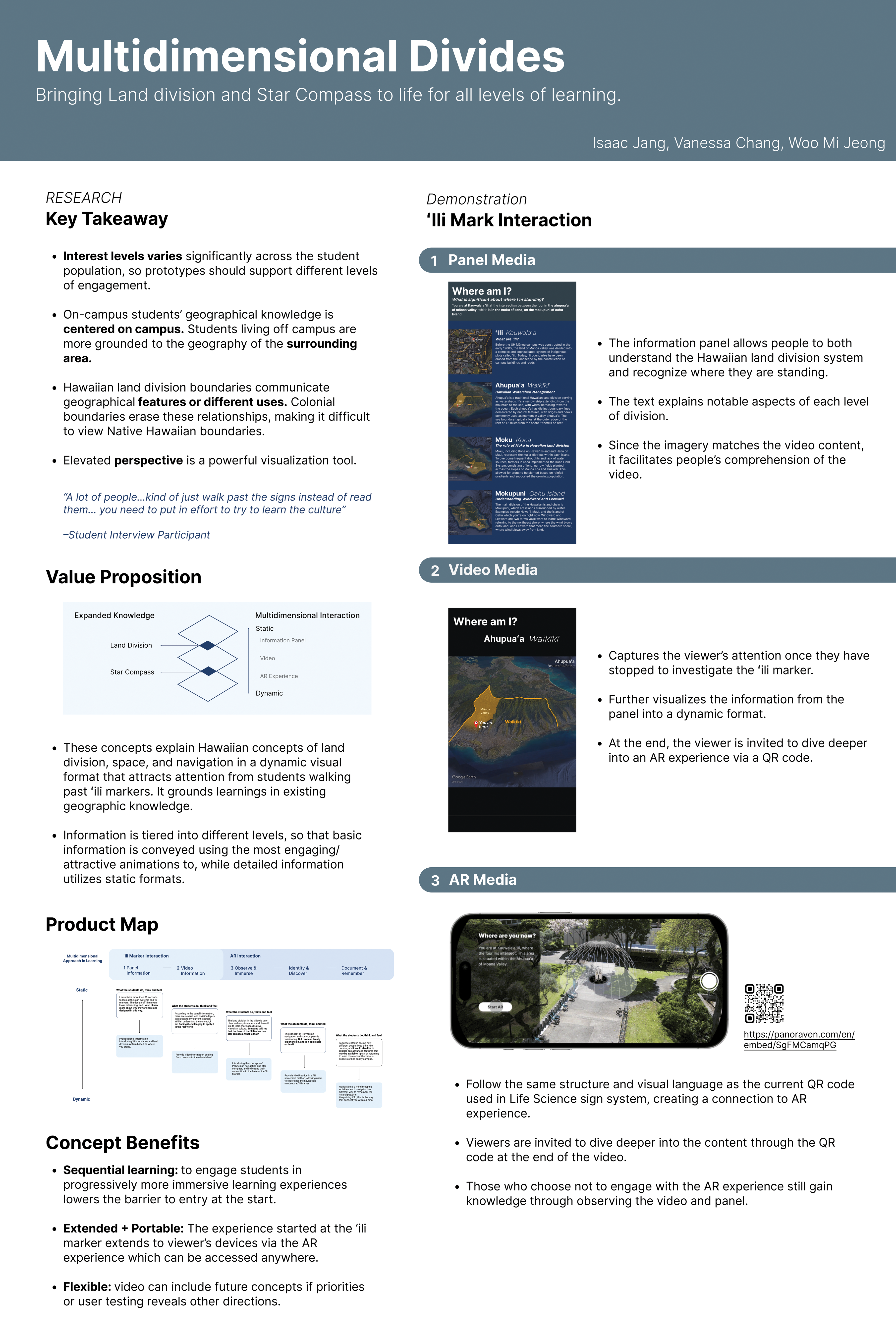
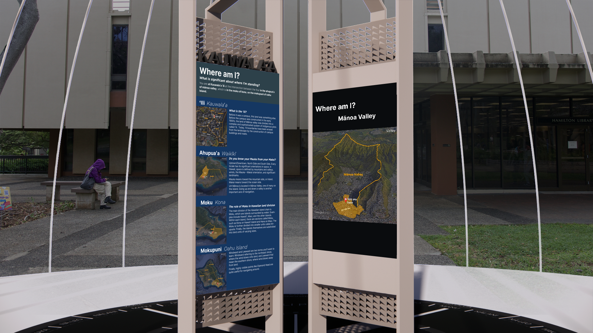
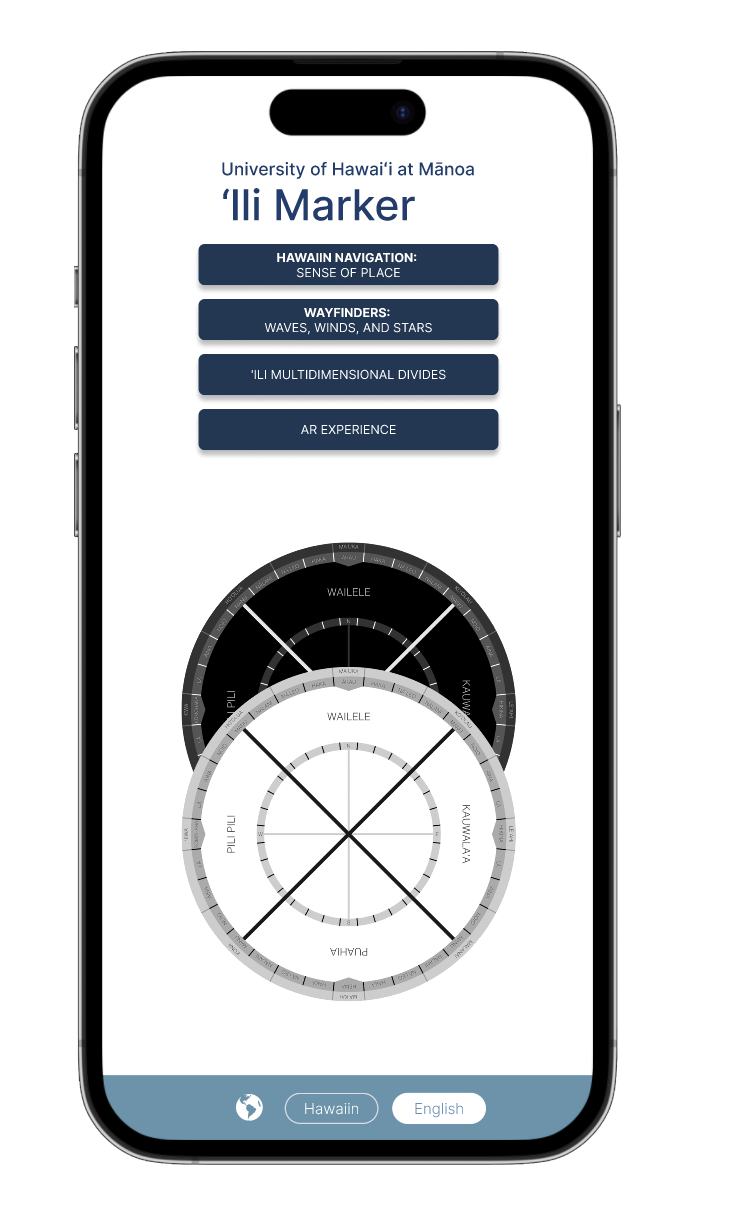
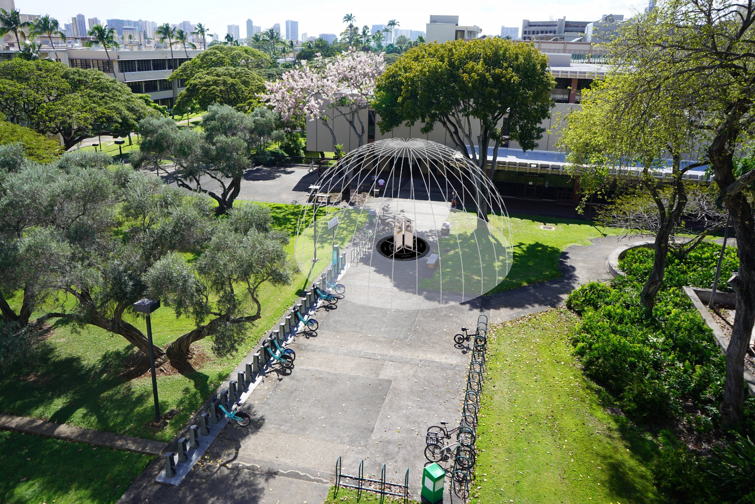
The team in charge of the project at the University of Hawaii at Mānoa developed two concepts to visualize the historical land division boundaries on campus and to make the Star Compass concept more relatable by using augmented reality. To achieve this, the team utilized photography, drone footage, and 3D mapping software over several weeks. The end product features an information panel, a digital display, and an animated camera to take viewers on a virtual tour of Oahu using 3D satellite imagery. Additionally, viewers can experience an augmented reality dome that overlays the Star Compass on their surroundings, enabling them to reflect, learn and document the content. The project offers various levels of information for viewers to access. The use of augmented reality and 3D mapping technology has made it possible for viewers to learn about the history of land division and the Star Compass concept in a more engaging way. The incorporation of familiar surroundings also enhances the viewers’ understanding of the content and its relevance to their daily lives. The project is an excellent example of how technology can be used to create immersive and educational experiences that inspire and engage audiences.
Project Details
- Class: Communication Design Workshop
- Instructor: Tomoko Ichikawa
- Project Partner: University of Hawai'i, Communication Design Center